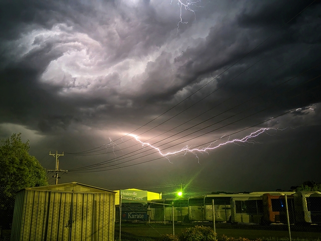
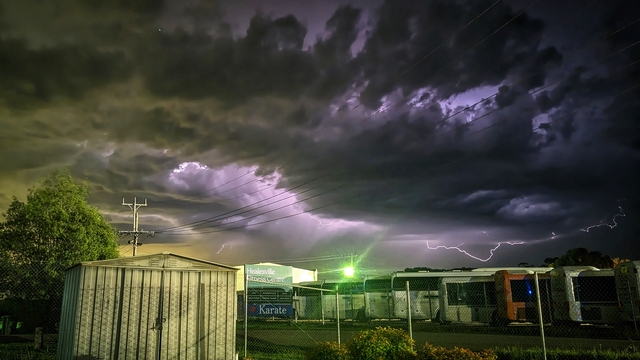
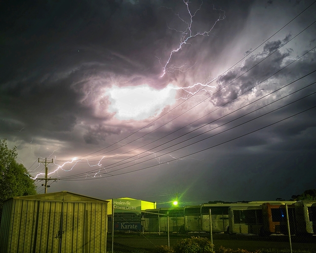
A rare “elevated supercell thunderstorm” passed through the Yarra Valley and lit up the skies at 10pm on 24 November.
Members of the public watched on in awe at the lightning and snapped some magnificent, almost otherworldly, photographs.
Pictures of spiralling storm clouds and jagged lightning were shared across social media.
Stuart Coombs, who worked as a Bureau of Meteorology forecaster for 25 years, took to Facebook to explain the rare phenomenon.
“Last night’s thunderstorm was what meteorologists refer to as an elevated supercell thunderstorm. These storms draw on air from well above the surface to fuel the updraft that sustains the storm and are not directly connected to the air near the surface at all,” Mr Coombs said.
As rain falls in a storm, it normally “chokes off” the rising up draft and kills the storm, Mr Coombs explained.
But these elevated supercell thunderstorms are often long lived as its rotating up draft causes any precipitation to be flung out it.
“Elevated supercell storms aren’t as dangerous as surface based ones because the moisture available above the surface is less than that lower down and thus the fuel to accelerate the updraft and hold growing hail aloft as well as intensify the spin of the storm is less.
“In summary then, if you have to have a supercell thunderstorm – elevated ones are best from a safety and property damage point of view. And they are often spectacular from the perspective of lightning generation – given the high cloud base shows off the display – especially at night,” Mr Coombs said.