Data released this month by the Climate Council has revealed just how many households are at risk from the after-effects of environmental hazards and climate pollution.
The new report titled ‘At Our Front Door’ analysed the risk faced at a national level and also guided the Climate Risk Map, an interactive map that provides a general guide of the climate risk faced by households in each electorate or suburb.
The Climate Council’s Emergency Leaders for Climate Action Director Sean O’Rourke said climate risks are hitting Australian households hard.
“With disasters becoming more frequent and severe, insurance premiums are skyrocketing, making insurance increasingly unaffordable or even unavailable for many,” he said.
“Already, more than 650,000 homes and businesses nationwide are classified as high risk, these properties face significant challenges in getting insured at all,”
“As premiums climb, more households are forced to under-insure or go without cover altogether, leaving them dangerously exposed to extreme weather events, this isn’t just a localised issue, it’s affecting Australians everywhere and driving up living costs dramatically.”
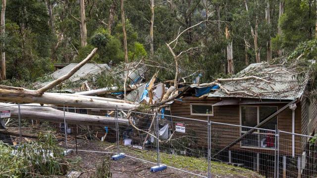
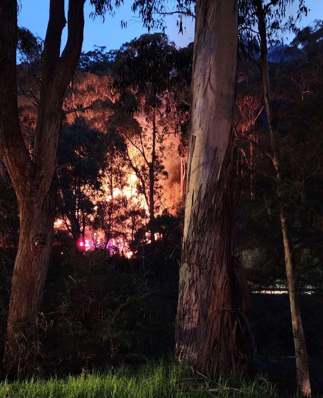
A number of townships in the Yarra Ranges have concerningly high levels of climate risk, with climate-fuelled flooding, bushfires, tropical cyclone winds, coastal inundation, and extreme wind all considered nationwide:
100 per cent of properties in Mount Dandenong, Ferny Creek, Sherbrooke, Clematis and Selby are at risk
99.7 per cent of properties in Olinda and 99.3 per cent in Kalorama are at risk
Belgrave, Belgrave Heights, The Patch, Menzies Creek, Cockatoo and Kallista all had risk levels above 87 per cent
Over three quarters of properties in Tecoma, Upwey, Avonsleigh and Emerald are at risk
Mr O’Rourke said suburbs like Kalorama, Mount Dandenong, Sassafras, and Olinda are essentially classified as critical climate risk zones, where nearly every single property faces high levels of risk from climate-fuelled disasters.
“In such areas, widespread damage is highly likely when disasters strike, meaning these communities urgently need targeted support from state and federal governments, including measures to build the resilience of their homes to future climate-fuelled disasters,” he said.
“The data paints a stark picture: without immediate action, these communities face devastating economic and social consequences.”
Despite being more densely populated, Montrose (36 per cent), Mt Evelyn (34.5 per cent) and Monbulk (42.6 per cent) also had relatively high levels of risk
Mr O’Rourke said even in more densely populated areas like Montrose, Mt Evelyn, and Monbulk, having between a third to nearly half of all properties at climate risk indicates significant vulnerability.
“This level of exposure means many residents may be already feeling the pinch of escalating insurance premiums,” he said.
“It’s critical that residents are aware of these risks, and that governments at all levels proactively support measures to climate-proof homes, build community resilience, and significantly reduce climate pollution to prevent these risks from escalating further.”
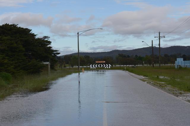
Over in the Valley, 54.8 per cent of properties in Yering are at risk solely due to the threat of riverine flooding and 19.3 per cent of Yarra Glen households are at risk, mostly due to the same issue.
In the Upper Yarra, Millgrove (19 per cent), Warburton (19.5 per cent), Powelltown (19.4 per cent), Big Pats Creek (26.1 per cent), East Warburton (28.1 per cent) and Reefton (20.2 per cent) are the key risk townships.
Interestingly, despite the sentiment of many residents, all of the Upper Yarra and Yarra Valley, including Healesville and Yarra Glen, are considered to have 0 per cent of properties at risk of bushfire.
Overall, the report found that a quarter of properties in the Casey electorate face climate risk, despite no neighbouring electorate, even rural electorates to the east, having risk percentages over 15.7 per cent.
Aston has a risk percentage of 3.8 per cent, Deakin 5.5 per cent and Latrobe 9 per cent.
Mr O’Rourke said firstly, residents should assess the specific risks facing their properties using tools like the Climate Council’s Climate Risk Map.
“Armed with accurate information, homeowners can make informed decisions to climate-proof their homes through practical measures like retrofitting to better withstand bushfires or flooding but residents can only do so much at a household level,” he said.
“As the At Our Front Door report finds, we need all governments to stop making this problem worse by prolonging the use of coal, oil or gas, residents can demand stronger climate policies at every government level to address the root causes of these worsening climate risks.”
To view the Climate Risk map, visit: climatecouncil.org.au/resources/climate-risk-map/?
To view the At Our Front Door report, visit: climatecouncil.org.au/resources/escalating-climate-risks-for-aussies-homes/?.
Mr O’Rourke said ultimately, while individual actions matter greatly, addressing climate risk at this scale requires comprehensive government intervention and substantial investment in community resilience.
“The climate risks we face today are the result of decades of inaction—but we still have a choice about our future,” he said.
“The decisions we make now, especially when it comes to cutting climate pollution further and faster, will determine how many more Australian homes and businesses are put at risk.”