Hold onto your hats and be prepared for some wind action across the outer easter of Melbourne.
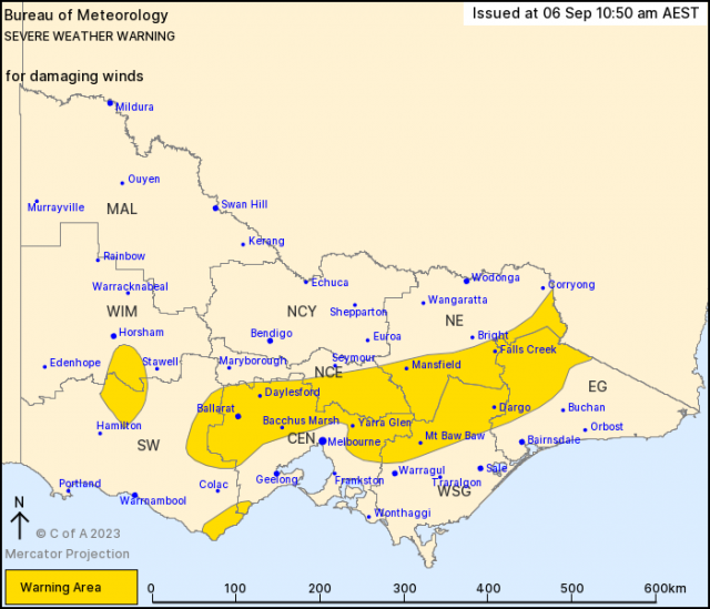
A severe weather warning has been issued by the BoM at 10:50 am Wednesday 6 September for damaging winds for people in parts of Central, East Gippsland, South West, North Central, North East, West and South Gippsland and Wimmera Forecast Districts.
A cold front will cross Victoria during Thursday as a low pressure system develops over waters to the southwest of the state.
Strengthening northerly winds are expected ahead of the front.
Strong northerly winds averaging 50 to 60 km/h with damaging wind gusts of around 90 km/h are possible over the Grampians, Otways and central ranges of Victoria from Thursday morning, as well as for the outer northern suburbs of Melbourne.
Winds will increase during the late afternoon and evening over the higher terrain of Gippsland and the North East.
Winds in the Melbourne area and central ranges of the state should ease below warning thresholds by Thursday afternoon, though are likely to remain fresh and gusty into Friday morning.
Due to uncertainty over positioning and development of the low pressure system to the south of Victoria, continued warnings may be required into Friday morning for western and eastern parts of the state.
The State Emergency Service advises that people should:
* If driving conditions are dangerous, safely pull over away from trees, drains, low-lying areas and floodwater. Avoid travel if possible.
* Stay safe by avoiding dangerous hazards, such as floodwater, mud, debris, damaged roads and fallen trees.
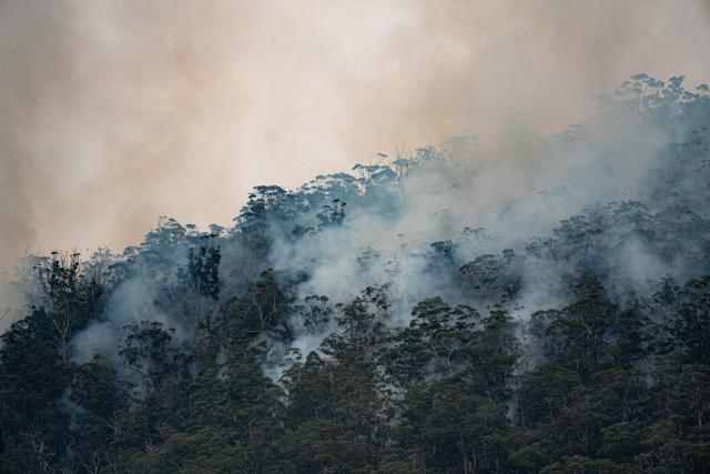
* Be aware – heat, fire or recent storms may make trees unstable and more likely to fall when it’s windy or wet.
* Check that loose items, such as outdoor settings, umbrellas and trampolines are safely secured. Move vehicles under cover or away from trees.
* Stay indoors and away from windows.
* If outdoors, move to a safe place indoors. Stay away from trees, drains, gutters, creeks and waterways.
* Stay away from fallen powerlines – always assume they are live.
* Be aware that in fire affected areas, rainfall run-off into waterways may contain debris such as ash, soil, trees and rocks. Heavy rainfall may also increase the potential for landslides and debris across roads.
* Stay informed: Monitor weather warnings, forecasts and river levels at the Bureau of Meteorology website, and warnings through VicEmergency website/app/hotline.
The next Severe Weather Warning will be issued by 5:00 pm AEST Wednesday.