Victoria’s Bushfire Risk Management Report for 2023-2024 was released in mid-December last year, sharing the efforts that went into fire management for the year and where fuel loads sit this summer.
Fire risk in the Port Phillip region which includes the Yarra Ranges, Cardinia, Knox and Maroondah LGAs, along with most of metropolitan Melbourne has reduced from the previous year but still remains above the target.
Forest Fire Management Victoria (FFMVic) Chief Fire Officer Chris Hardman said climate change is contributing to increasing levels of bushfire risk, following the La Niña conditions of recent years, conditions are now more favourable for planned burning.
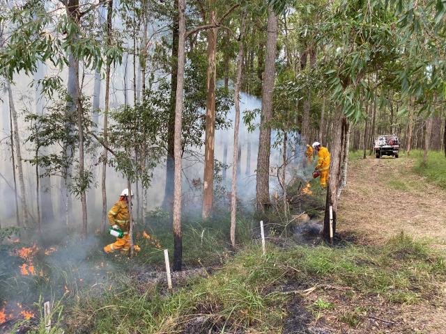
“Over the past year we have taken advantage of better conditions and reduced fuel-driven bushfire risk across more than 138,000 hectares of public land through planned burns and mechanical fuel treatments statewide fuel-driven bushfire risk below target,” he said.
“We reduce bushfire risk in many ways – from preventing new ignitions through fire bans and campfire controls, early detection of bushfires from our fire towers and reconnaissance flights, aggressive first attack by aircraft, rappel firefighters and ground crews to keep bushfires small.”
Fuel-driven fire risk, previously referred to as ‘residual fire risk’, is the amount of bushfire risk that remains after bushfires and fire management activities, such as planned burns, have taken place. 100 per cent would represent the maximum risk, where the build-up of fuel loads wasn’t reduced by any planned burns or major fires.
A target of at or below 85 per cent of maximum levels has been set for Port Phillip, up from the 80 per cent target set in 2015 until the boundary was redrawn in 2019.
Currently, Port Phillip’s fuel-driven fire risk is at 87 per cent, with forest fuel loads in outer Metropolitan Melbourne, which stretches out to townships like Lilydale, Wandin, Silvan and Belgrave at 92 per cent and the Yarra District, which includes high-fire risk townships like Yarra Glen, Warburton, Emerald and Gembrook at 86 per cent.
These figures have reduced from 89 per cent, 95 per cent and 88 per cent respectively but still remain above the 85 per cent target. The 85 per cent target has previously been criticised, namely by the late professor Kevin Tolhurst who helped develop the computer model which calculates fuel-driven bushfire risk, to being equivalent to accepting a similar level of bushfire impact as was seen on Black Saturday.
The wet forests to the north and east of Melbourne such as the Yarra Ranges create the majority of the Port Phillip region’s fuel-driven bushfire risk, and are difficult for conducting large-scale planned burning due to often being too damp, though drier conditions last year helped. Non-burn fuel treatments such as slashing and mowing are also utilised in areas like this. FFMVic also ramps up their response in areas where the risk remains above target, such as by prepositioning aircraft in the area on days of elevated fire danger.
Previous and ongoing litigation against the Department of Energy, Environment and Climate Action (DEECA), which manages FFMVic, does continue to restrict bushfire risk reduction works though the ongoing litigation DEECA is defending itself against relating to certain works in the Central Highlands, to date has not had direct impacts on bushfire risk management operations.

